Resources for infrastructure
A 21st century economy depends on an efficient infrastructure network. The Geological Survey of Northern Ireland (GSNI) looks at how Northern Ireland’s mineral resources have influenced the development of its infrastructure and the role that GSNI’s data will play in shaping its future.
Mineral resources are vital for a developing economy; they are the raw materials that build our homes, offices and hospitals, our road and rail networks and our information technology infrastructure. The occurrence of, and proximity to, these resources has long influenced our built environment.
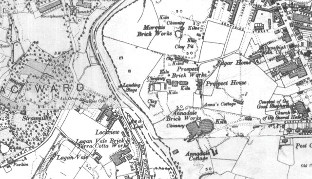
One example is the distinctive ‘Belfast Brick’ which was made from stone-free, red plastic clays from the Triassic-age Mercia Mudstone Group that were extensively worked in the Belfast area and the Lagan Valley during the latter half of the 19th and the first half of the 20th century. Elsewhere the sandstone used in Belfast Castle and the Albert Clock was quarried from Scrabo in County Down as the Belfast and County Down Railway meant it could be easily transported from Newtownards to Belfast.
Today, the high quality aggregates sourced in Northern Ireland’s quarries are of particular importance for use in road surfaces. Due to the hardness and wear-resistance of the greywacke (sandstone) found in counties Down and Armagh, this material is used to provide increased skid-resistance thereby contributing to improved road safety across Northern Ireland. In figures published by the Mineral Products Association Northern Ireland (MPANI) the aggregates industry in Northern Ireland directly employs some 5,000 people, produces approximately 22 million tonnes of aggregate per year and contributes to a turnover of around £650 million per year (3 per cent of Northern Ireland GDP).
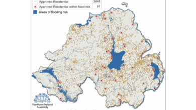
In 2012 GSNI produced a series of Mineral Resource maps, together with the British Geological Survey (BGS), to aid the conservation and safeguarding of minerals. These maps and information derived from them are currently being used by the 11 District Councils across Northern Ireland as they draft their individual development plans. Assisting with strategic decision making in respect of mineral extraction, these maps are contributing to the sustainable development of mineral resources and helping to ensure that they are not sterilised by other developments thus leaving insufficient supplies for future generations.
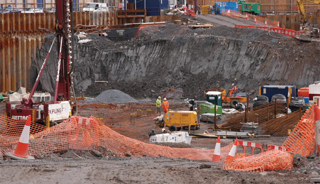
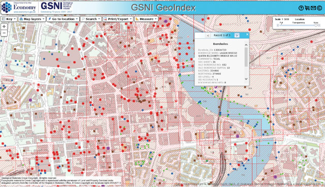
The GSNI’s data archive not only contains information on the location and historical use of minerals but provides access to geological mapping and site investigations collated throughout the GSNI’s history. While much of this information has been deposited with the GSNI in paper or PDF format these data are valuable in the early stages of infrastructure projects as it is important to understand the engineering challenges of the ground on which we live and the potential costs required to ‘de-risk’ a development project. Access to GSNI’s data informs the planning and development of infrastructure schemes e.g. the Belfast Sewer Tunnel, the A26 road corridor and Gas to the West.
Digital Transformation
In 1991, the Association of Geotechnical and Geoenvironmental Specialists (AGS) created the AGS Data format to transfer ground investigation, laboratory testing and monitoring data between the contributing parties of a project which involves geotechnical or geoenvironmental elements. The AGS data allows this transfer of data independent of software, hardware or operating system and is strongly supported by a forward thinking geotechnical and geoenvironmental community.
Accessing Subsurface Knowledge (ASK) is a data and knowledge exchange network between the public and private sector developed between the BGS and Glasgow City Council to enable better use and re-use of data. ASK began as a pilot project and with strong support from across the industry helped to establish a data transfer mechanism to a centralised national repository for raw subsurface data, based upon the AGS data format, to maximise accessibility and re-use of data.
Following the success of the ASK network in Scotland, GSNI and BGS are now collecting, validating and publishing AGS data format files to enable better re-use of ground investigation data within Northern Ireland and its assimilation into 3D geological models. GSNI wishes to encourage open access AGS data donation through public sector contract frameworks as well as on a voluntary basis through the ASK NI initiative launched in partnership with the Institute of Civil Engineers NI Year of Infrastructure.
Working with Construction and Procurement Delivery (CPD) in the Department of Finance, data procured through the Pan Government Collaborative Framework Agreement for Ground Investigation Works are being made available for re-use under the Open Government Licence. This is an open data resource for users in government, councils, industry, academia and NGOs which will deliver savings in construction costs, enhance environmental protection and provide greater public safety from hazardous ground conditions e.g. subsidence, compressible ground.
In addition to providing access to the information contained within the AGS data format files, these data also allow the GSNI to refine existing 3D Geological models of the subsurface, produce more detailed maps of the depth to bedrock, and enhance a physical rock properties database. Using digital data to refine these maps and models results in an efficient process to deliver new tools to aid our understanding of the subsurface and provide a valuable data asset for future infrastructure projects.
For further information on ASK NI visit www.bgs.ac.uk/gsni/ags or to donate data please contact:
Alex Donald, Geological Survey of Northern Ireland, Dundonald House, Upper Newtownards Road, Belfast, BT4 3SB.
T: 028 9038 8462
W: www.bgs.ac.uk/gsni/ags
E: gsni@economy-ni.gov.uk
Twitter: @GeoSurveyNI
![]()