
Foundations for critical infrastructure decisions

The Geological Survey of Northern Ireland (GSNI) hosts experts from across the planning, geoscience, and environmental sectors for a round table discussion on the foundations for critical infrastructure decisions.
Where do infrastructure policy and investment ambitions diverge from subsurface realities, and what are the impacts on cost, consent, delivery, and public confidence?
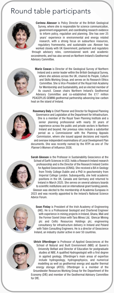
Marie Cowan
Delivering major projects has become increasingly complex due to population growth, technological change, and climate pressures. Across the UK, major infrastructure schemes have faced challenges around value for money, uncertainty, governance, and cost overruns, with delays in Northern Ireland alone estimated to cost between £700 million and £1.94 billion. These issues compound over time and undermine confidence in delivery. A key factor is the lack of robust evidence at the earliest stages of project planning. Subsurface understanding is not a luxury but an essential part of good public decision-making. Northern Ireland already holds valuable datasets, but the challenge is adopting a more systematic and integrated approach so that this information consistently de-risks future infrastructure delivery.
Ulrich Ofterdinger
In Northern Ireland, geology is highly varied, with complex rock formations and overburden deposits that create additional risks for development. Without adequate baseline data, projects are more vulnerable to delays, redesigns, and escalating costs. These overruns reinforce public perceptions that infrastructure projects are poorly planned and badly managed. Providing consistent and accessible subsurface data at an early stage would allow developers to anticipate challenges, design projects more effectively, and reduce uncertainty, ultimately improving delivery.
Rosemary Daly
The planning system in Northern Ireland is under growing pressure to support infrastructure delivery, decarbonisation, and climate adaptation while also rebuilding public confidence through greater certainty and faster decision-making. Reliable subsurface knowledge is therefore extremely valuable because it strengthens the evidence base underpinning development plans and infrastructure proposals. Better information at the outset reduces uncertainty, improves project phasing, and supports higher-quality design outcomes from the start. For investors, understanding the physical constraints and opportunities of a site allows developers and infrastructure providers to anticipate challenges before committing resources.
Sean Finlay
Infrastructure policy and investment decisions must incorporate subsurface information because, without it, project delivery is inevitably compromised. Poor or incomplete subsurface data increases the likelihood of delays, overspending, and underperformance. A significant issue is that many enterprise and economic development agencies do not fully appreciate the importance of geoscience and subsurface evidence. If infrastructure projects are weakened by inadequate data, the wider economic development those agencies seek to promote is also undermined.
Sarah Gleeson
Infrastructure planning and climate resilience strategies should begin with an understanding of the subsurface. Applied geoscience provides essential evidence for making better long-term decisions on infrastructure, climate adaptation, and mitigation. Many projects experience delays because subsurface conditions are considered too late in the process. Addressing these issues earlier reduces uncertainty, improves confidence among contractors and investors, and lowers overall project risk.
Additionally, expanding critical infrastructure such as housing depends on raw materials such as aggregates and cement, which ultimately come from the subsurface. These resource demands are often overlooked in planning and there are also social acceptance and environmental challenges associated with extracting them.
Corinna Abesser
UK infrastructure ambitions increasingly depend on the subsurface, requiring an evidence base that reflects geological variability and uncertainty. Yet valuable geological and ground investigation data collected through infrastructure projects are frequently used only once before being archived or lost, even when publicly funded. This creates inefficiencies, duplicated costs, and missed opportunities to build a shared evidence base. As a result, projects more frequently encounter unexpected ground conditions that drive overruns and weaken public confidence. Countries such as Germany and the Netherlands require geological data sharing, demonstrating that accessible subsurface information can reduce project failures and deliver significant national savings.
How well is shallow subsurface evidence integrated into early infrastructure design, and how could this improve delivery certainty, environmental performance and community outcomes?
Sean Finlay
Any well-designed infrastructure project should include a substantial subsurface component from the outset, and there is a strong argument that this should become mandatory. The financial implications of failing to do so are significant. The scale of costs associated with inadequate subsurface information is striking, and regardless of what proportion of total infrastructure spending it represents, it is still money that could be far better spent elsewhere through more informed planning and early-stage investigation.
Sarah Gleeson
Subsurface evidence should be embedded much earlier in planning and design processes, particularly where there are opportunities to connect infrastructure delivery with climate resilience and energy innovation. For example, excess heat generated by data centres could potentially be stored in the subsurface and linked to district heating systems in urban areas, creating more sustainable infrastructure outcomes. However, these kinds of projects often struggle to gain market confidence because investors want proof that the technology works at scale. Demonstrator projects, such as some of the geothermal initiatives already underway in Ireland and Europe, are therefore critical to building confidence.
Corinna Abesser
Every year, around £1.3 billion is spent in the UK on ground investigations for infrastructure projects, yet much of this data is never deposited or shared. As a result, investigations are repeatedly duplicated, increasing costs and inefficiencies, while limiting wider benefits such as improving national geological models. The British Geological Survey already provides mechanisms for data submission and sharing, but returns in Britain remain low even from large, publicly-funded infrastructure projects. The problem is therefore not technical but systemic. Reusing existing data could deliver considerable efficiency savings but will require stronger incentives or requirements to share data.
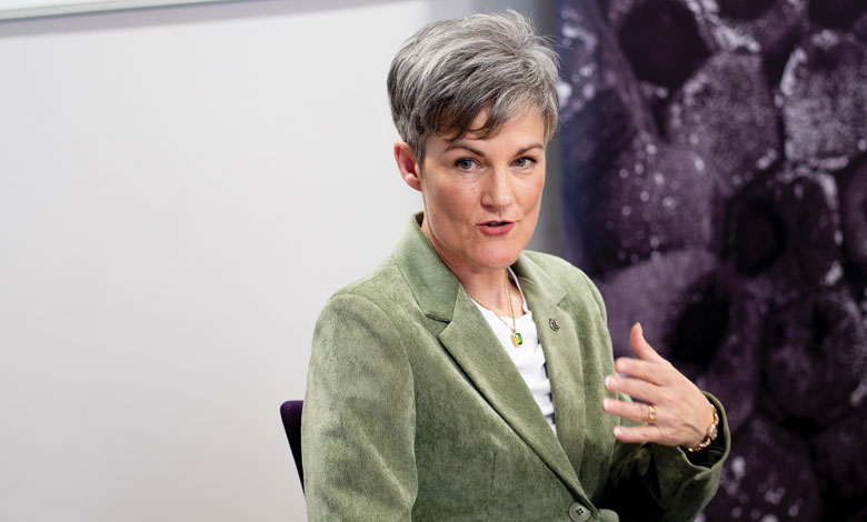
“Subsurface understanding is not a luxury but an essential part of good public decision-making.”
Marie Cowan
Marie Cowan
Northern Ireland already possesses an exceptional range of subsurface and surface datasets, including LiDAR, digital terrain models, flood risk, coastal and peatland data. The challenge is integrating these more strategically across government. Initiatives such as the TELLUS and GeoEnergy NI projects plus new groundwater, engineering geology, and peat slide susceptibility maps already demonstrate the value of accessible evidence for infrastructure delivery and climate resilience. Importantly, the Department for Finance has piloted contract clauses requiring geotechnical data generated through public-procured projects to be shared, resulting in thousands of additional borehole data to captured. There is the opportunity to scale this into a fully coordinated, pan-government system where data from all sectors can be shared, integrated, and enhanced through technologies such as AI to improve long-term planning and delivery certainty.
Ulrich Ofterdinger
Specialists working on infrastructure projects may know how to access the specific datasets relevant to their discipline, but integrating those datasets into a coherent and shared interpretation remains difficult. Different agencies collect and manage information in different ways, meaning valuable evidence is often inaccessible to those outside specialist networks. While there are strong examples of integrated platforms, such as the TELLUS dataset and the Northern Ireland Coastal Observatory, these remain exceptions rather than the norm. For technologies such as AI and machine learning to support infrastructure planning effectively, data must be easier to find, compatible across systems, and openly accessible.
Rosemary Daly
Having access to high-quality existing data allows planners and developers and infrastructure investors to identify whether projects are viable before major costs are incurred. Better evidence leads to more realistic programmes, improved environmental performance, and infrastructure that is better suited to the communities it serves. The subsurface shapes landscapes, ecosystems, settlements, and even patterns of drainage and development, providing meaningful local environmental information and understanding which is critical. Communities themselves often hold valuable knowledge about how landscapes behave, where flooding occurs, or which areas are unsuitable for development. Respecting that knowledge, alongside scientific evidence, helps ensure infrastructure is delivered more sensitively, sustainably, and in ways that protect the character and environmental value of local areas.
What role should deep subsurface knowledge play in long-term infrastructure and energy decisions, and what evidence and governance are needed to support responsible investment?

“Excess heat generated by data centres could potentially be stored in the subsurface and linked to district heating systems in urban areas, creating more sustainable infrastructure outcomes.”
Sarah Gleeson
Sarah Gleeson
Since subsurface systems do not follow political boundaries, an all-island approach to data and planning, such as that demonstrated through the TELLUS programme, is especially valuable. However, two key challenges remain. First, communicating deep subsurface issues to communities is difficult because people cannot easily visualise what exists underground and technical scientific explanations often fail to engage the public effectively. Second, there are increasingly complex questions around competing uses of the subsurface, including geothermal development, drinking water protection, and major infrastructure projects. Long-term planning therefore requires governance frameworks capable of balancing multiple interests while ensuring communities are meaningfully involved in decision-making.
Rosemary Daly
Better understanding of groundwater, drainage systems, habitats, and wider ecological relationships beneath the surface supports faster and more informed decision-making. Increasing the quality and amount of information submitted early in the planning process helps avoid situations where problems only emerge halfway through development or planning cycle. The more knowledge available at the beginning of a project, the more effectively infrastructure and development can be planned in a way that balances development needs with environmental protection and long-term sustainability for communities and natural systems alike.
Marie Cowan
Across Northern Ireland, large volumes of geoscience, planning, and environmental data already exist. If these datasets were systematically extracted, integrated, and shared, they could significantly improve future decision-making and investment certainty. An all-island approach is especially important because geology, water catchments, and environmental pathways do not stop at borders. Historical datasets also gain new relevance as priorities change. Demonstrator projects, combined with integrated governance and shared data systems, can help communities better understand emerging technologies and enable long-term infrastructure delivery.
Sean Finlay
A key requirement is the creation of coordinated, centrally curated datasets that combine information from both public and private sources, and make it readily accessible for future use. Many European countries already require developers to submit subsurface data to state or regional authorities, and similar approaches should be considered more widely. Importantly, subsurface systems do not stop at political borders or coastlines, so governance frameworks need to reflect the interconnected nature of geological and environmental systems through greater collaboration across jurisdictions.

“For technologies such as AI and machine learning to support infrastructure planning effectively, data must be easier to find, compatible across systems, and openly accessible.”
Ulrich Ofterdinger
Ulrich Ofterdinger
Subsurface spaces are being considered for multiple purposes, including geothermal energy, groundwater storage, flood mitigation, carbon storage, and seasonal heat storage. This creates competing demands that require careful long-term management, monitoring, and oversight. Governance therefore needs to ensure that decisions made today do not unintentionally sterilise the subsurface for future uses that may become essential for climate adaptation or mitigation. At the same time, there are significant investment opportunities emerging through sustainable finance mechanisms such as green bonds. Responsible investment will therefore depend on balancing innovation, environmental stewardship, and long-term strategic planning.
Corinna Abesser
Instead of allocating on a first come, first served basis, governance frameworks also need to look at subsurface use over time, considering 30- to 50-year planning horizons, to ensure current activities do not sterilise the subsurface for future needs or deplete resources. Geothermal energy is an important example. Many cities are expected to use the subsurface for heat extraction, storage, and balancing energy demand, yet heat is not recognised as a natural resource within existing legislation. This raises important questions about whether governance and licensing frameworks need to evolve so geothermal resources can be managed, regulated, and integrated into long-term infrastructure planning.
How should surface, shallow, and deep subsurface systems be integrated into climate resilience planning to 2050 and beyond, in a way that strengthens environmental resilience, economic outcomes, and social capital?
Rosemary Daly
Better subsurface understanding allows planners to allocate land more effectively, identify development limits, and phase infrastructure in ways that reflect real environmental constraints. This leads to more environmentally responsible outcomes and strengthens confidence in planning processes such as the local development plan delivery. As more robust subsurface information is embedded into local development plans, certainty for investors increases and planning decisions become more transparent and trusted. This also supports a shift towards more integrated design approaches that account for environmental systems beneath the surface, ensuring infrastructure is better aligned with both ecological conditions and long-term resilience objectives.
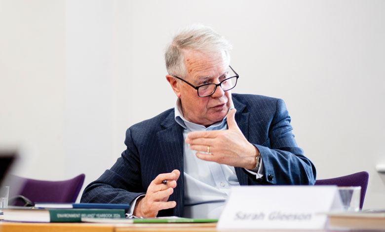
“Any well-designed infrastructure project should include a substantial subsurface component from the outset, and there is a strong argument that this should become mandatory.”
Sean Finlay
Ulrich Ofterdinger
Geothermal energy provides an indigenous, low-carbon source for heating and cooling, helping decarbonise one of the largest sources of emissions and reducing reliance on external energy systems. The subsurface also supports climate adaptation through groundwater management and the storage of excess water during wetter periods for subsequent use during droughts. In addition, identifying subsurface energy ‘hotspots’ can help guide the location of industries that are energy-intensive, improving efficiency and reducing environmental impact.
Marie Cowan
A systems-based approach, similar to an integrated energy or climate dashboard, could bring together real-time data on water levels, temperature, chemistry, subsidence, and other environmental indicators to support dynamic decision-making. This could evolve into digital twins of local council areas, allowing planners to test scenarios in advance and prepare for events such as landslides, floods, or coastal risks. Such systems would support proactive risk management rather than reactive responses, improving resilience in the face of increasing climate emergencies. Given the exposure of critical infrastructure to climate risk and environmental change, integrating subsurface intelligence would strengthen economic stability and public safety.
Corinna Abesser
Success of climate adaptation depends on subsurface processes: flood risk is linked to infiltration and groundwater levels, drought resilience depends on groundwater storage, and nature-based solutions are closely linked to soil systems. A whole-system view is therefore required, recognising subsurface processes as equally important as surface conditions. Recent engagement with planning professionals also highlights the need for better data availability, improved visibility of subsurface use, and stronger data stewardship. Better alignment between planning, regulation, and subsurface knowledge can deliver more coordinated and effective climate adaptation outcomes.

“Accessible subsurface information can reduce project failures and deliver significant national savings.”
Corinna Abesser
Sarah Gleeson
Climate resilience planning must include the concept of the subsurface as system, as all surface, shallow, and deep subsurface processes are interconnected such as flooding, biodiversity, groundwater, geology, and coastal change, and all impact infrastructure resilience. The subsurface also contains valuable records of past climate and environmental change, providing an important archive for understanding long-term Earth systems. Advances in technology now allow much more sophisticated monitoring and modelling of subsurface and infrastructure health. These tools can be used to track embankment stability, peatland conditions, and other critical systems in real time, improving early warning and risk management.
Sean Finlay
Climate resilience planning should prioritise the subsurface as a key component of national infrastructure strategy, particularly through geothermal energy development, subsurface storage, and resource security. In addition, ensuring access to critical raw materials is essential for long-term resilience and aligns with broader UK and European policy goals around reducing external dependencies. These uses highlight the strategic importance of the subsurface not only for environmental resilience but also for energy security and economic stability. A coordinated focus on these areas will be essential for building a resilient infrastructure system capable of supporting future climate and resource challenges.
How can subsurface data from infrastructure projects be better shared and re-used to build a national evidence base, and what governance is needed to manage it in the public interest?
Corinna Abesser
Geological surveys see part of their role as collecting, curating, and facilitating access to this information, but the main challenge is that much of the data never becomes accessible in the first place. Voluntary approaches and contractual arrangements have had limited success in Britain, so stronger mandates may now be necessary, particularly for publicly funded projects. Data generated using public money should be returned to a public body, such as a geological survey, where it can be made available for wider use. Evidence from the Netherlands and Germany shows that mandatory data sharing improves planning, project delivery, cost control, and long-term infrastructure outcomes.
Sean Finlay
Mandatory reporting of subsurface data to a central agency, most likely a national geological survey, is the most effective long-term solution for building a coherent and reusable national evidence base.
Sarah Gleeson
Subsurface data should be treated as a strategic national resource, requiring long-term investment in curation, archiving, protection, and accessibility to all stakeholders. The ambition for subsurface data sharing should extend beyond geosciences alone. Germany’s National Research Data Infrastructure provides a strong example, with data repositories covering earth sciences, chemistry, health, and other disciplines linked to the European Open Science Cloud. This enables large-scale data science and AI applications across sectors. There is also a significant opportunity for stronger all-island collaboration around geothermal energy, groundwater, and climate resilience planning for infrastructure.
Ulrich Ofterdinger
Large, accessible datasets can become powerful national assets when they are collected and managed in a standardised and interoperable way. Comparable examples already exist in sectors such as healthcare, where shared NHS data has helped drive innovation and new forms of analysis. In the same way, initiatives such as the TELLUS dataset demonstrate the value of making high-quality environmental and subsurface information openly available for industry, research, and applications that may not even yet be anticipated. Standardised data systems would also support the development of new analytical tools, including AI-based approaches, while making information easier for non-specialists to access and interpret.
Rosemary Daly
At present, often approaches can be fragmented. A more joined-up system would improve understanding and increase the value of the information already being collected. Responsibility should not rest solely with public bodies; investors and developers also have an important role to play. Better accessibility and standardisation would support public decision-making and private investment, helping ensure that everyone involved knows what information exists, how it can be used, and how it can contribute to more efficient and informed infrastructure delivery.
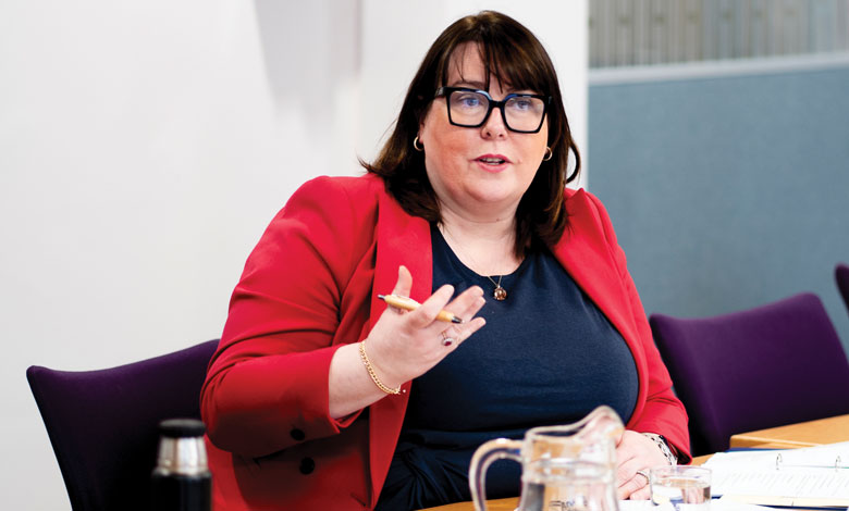
“Increasing the quality and amount of information submitted early in the planning process helps avoid situations where problems only emerge halfway through development.”
Rosemary Daly
Marie Cowan
The future of subsurface data sharing lies in creating a much broader and more integrated ecosystem that extends beyond geoscience alone. Environmental science, engineering, planning, communication, and social science all need to interact if infrastructure and environmental challenges are to be addressed effectively. Models such as the Dutch ‘diamond approach,’ which brings together government, industry, researchers, and the public, offer a useful framework for collaboration. There is currently strong momentum for UK-Ireland cooperation, supported by shared geology, common climate and infrastructure challenges, and growing research collaboration. This creates an opportunity for a cross-border centre of excellence focused on the future of the subsurface, combining interdisciplinary research, shared learning, governance innovation, and public engagement to support economic development, environmental stewardship, and long-term strategic planning.
