Supporting coastal planning and climate resilience
The Geological Survey of Northern Ireland (GSNI) is playing a leading role in delivering the scientific evidence needed to support coastal planning, climate adaptation, and risk management.
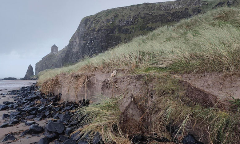
Northern Ireland’s coastline is one of our greatest natural assets, supporting communities, infrastructure, tourism, biodiversity, and economic activity. However, rising sea levels, increasing storm intensity, coastal erosion, and flooding are placing growing pressure on these environments.
As planners and policymakers seek to make informed decisions about future development, access to robust evidence on how the coast is changing has never been more important.
Through a combination of geological mapping, coastal monitoring, citizen science, and international research collaboration, GSNI is helping to build a clearer understanding of how Northern Ireland’s coastline is evolving and what this means for future planning decisions.
A cornerstone of this work is DAERA’s Northern Ireland Coastal Observatory, which brings together a comprehensive range of coastal datasets, maps, surveys, and monitoring information in a single accessible platform. The Observatory was established to improve the evidence base for understanding coastal change, raise awareness of climate impacts, and provide stakeholders with information to support the management of coastal environments.
In recent years, GSNI has delivered a number of DAERA-funded coastal evidence-gathering projects that have significantly enhanced our understanding of the geological controls on coastal change. These projects have produced the first Northern Ireland-wide coastal bedrock geology and superficial geology datasets, extending geological mapping from the land into the nearshore environment. These datasets help identify areas that may be more vulnerable to erosion or inundation and provide critical information on the materials and processes shaping the coast.
Alongside geological mapping, GSNI has contributed to the development of coastal sediment and seabed information, integrating data from LiDAR, bathymetric surveys, historical shoreline analysis, and geological investigations. Together, these datasets provide an increasingly detailed picture of how coastal systems function across various timescales and respond to hydrodynamic forcing, such as storms and sea-level rise, as well as human activity.
This foundational evidence will be used to support coastal vulnerability assessments, enabling planners and decision-makers to better understand current and future threats to our coast. As pressures on the coastline grow, these assessments are essential in informing sustainable management decisions and helping communities adapt to future climate-driven conditions.
GSNI is also contributing to several major research initiatives that are advancing understanding of coastal change at both local and national scales.
The UK Gravel Barriers Project is investigating how gravel beaches and barrier systems respond to long-term changing environmental conditions. These natural coastal features provide important protection against flooding and erosion, safeguarding the sensitive environments, such as lagoon or freshwater and saltmarsh habitats, as well as infrastructure located in the areas behind the barrier. Yet, understanding of their short- and long-term behaviour, and of their interactions with back-barrier environments, remains limited. Through the project, GSNI is helping to improve knowledge of gravel barrier dynamics and develop models that will support more sustainable coastal management and climate adaptation around the UK.
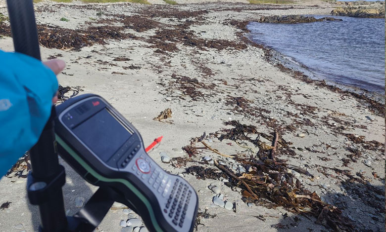
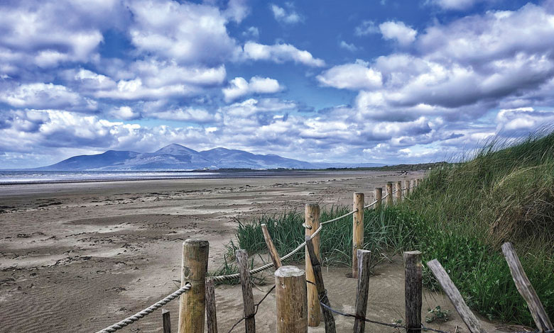
At a local level, the CO-creating COastal Resilience (COCOR) project is examining coastal change and the effectiveness of dune restoration at Tyrella Beach, County Down. Led by GSNI in partnership with Newry, Mourne and Down District Council, the project combines scientific monitoring, citizen science, and community engagement to evaluate how Nature-based Solutions (NbS) can enhance coastal resilience. Techniques including drone surveys, LiDAR analysis, RTK-GPS monitoring, and CoastSnap citizen-science observations are helping build a long-term record of change within this important dune system.
GSNI is also a partner in the recently launched Coastal Monitoring and Adaptation Planning (CMAP) project, a €9.6 million PEACEPLUS-funded initiative led by Ulster University. Covering coastal sites across Northern Ireland and Ireland, CMAP will combine scientific monitoring, habitat restoration, and community engagement to develop evidence-based adaptation strategies. The project seeks to provide decision-makers with better information about coastal change, adaptation options, and practical responses to climate and biodiversity challenges.
Beyond coastal monitoring, GSNI’s participation in the EU-funded Platform for Atlantic Geohazards Risk Management (AGEO) project demonstrated how citizen observatories and Earth observation technologies can support hazard monitoring and risk management. Through the Giant’s Causeway and Carrick-a-Rede Citizens’ Observatory, GSNI successfully integrated community observations with geological and environmental data, helping to inform management decisions in sensitive coastal environments.
Collectively, these projects are delivering far more than scientific datasets. They are creating the evidence base needed to support implementation of the Northern Ireland Climate Change Adaptation Programme (NICCAP3) and the ambitions of the Climate Change Act (Northern Ireland) 2022 by improving understanding of climate-related coastal risks, actively monitoring changes and strengthening resilience planning.
The benefits also extend directly into the planning system. Local councils are increasingly considering climate change, coastal risk, and resilience within their local development plans (LDPs). Meanwhile, planning authorities must ensure that development proposals align with the principles of the Strategic Planning Policy Statement (SPPS), including avoiding inappropriate development in areas vulnerable to natural hazards and climate-related risks. Reliable, up-to-date coastal evidence is therefore essential to support sound planning decisions.
As climate change continues to reshape our coastlines, evidence-led planning will become increasingly important. Through investment in monitoring, mapping, research, and collaboration, GSNI is helping to ensure that Northern Ireland’s planners, policymakers, and communities have the information needed to support informed decisions today while preparing for the challenges of tomorrow.
Kirstin Lemon, Melanie Biausque, and Kieran Parker
Click here to find out more:
T: 028 90388662