Outstanding natural beauty

There are eight areas of outstanding natural beauty (AONBs) in Northern Ireland. These are: Antrim Coast and Glens; Binevenagh; Causeway Coast; Lagan Valley; Mourne Mountains; Ring of Gullion; Sperrins; and Strangford and Lecale.
The power to designate an AONB is derived from the Nature Conservation and Amenity Lands (Northern Ireland) Order 1985. Such designation determines that an area of natural landscape has wider strategic importance and enables the Northern Ireland Environment Agency develop proposals for:
• the conservation or enhancement of natural beauty and amenities within it;
• the conservation of wildlife, historical artefacts or natural phenomena;
• the promotion of its enjoyment by the public; and
• the provision and/or maintenance of public access.
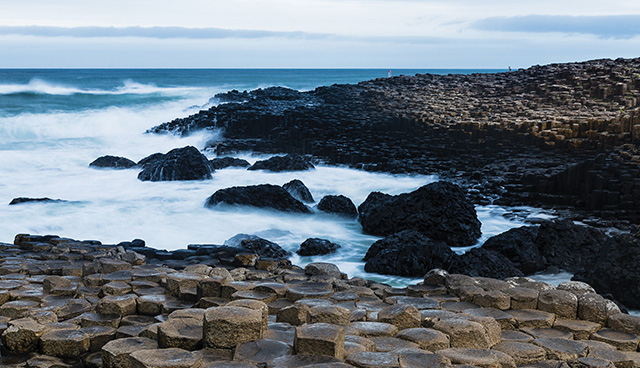
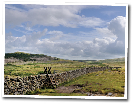
Causeway Coast
County: Antrim
Designated: 1989
The Causeway Coast AONB encompasses 18 miles of coastline and contains the only World Heritage Site in Northern Ireland; the Giant’s Causeway.
Prior to being retitled ‘the Giant’s Causeway’, the area was referred to in Gaeilge as ‘Clochán na bhFomhóraigh’, ‘stepping stones of the Fomhóraigh’, who, in Irish mythology, are a supernatural race.
According to the Fenian Cycle, the distinct columns are the remains of causeway built by a mythical hunter-warrior Fionn mac Cumhaill, portrayed as giant, who was challenged to fight Scottish giant Benandonner. The challenge was accepted and the causeway built across the North Channel so that the two giants could meet.
Beaches include Portrush’s East Strand and White Rocks, as well as Bushfoot Strand in Portballintrae and White Park Bay. Locations such as White Park Bay and Portrush are home to Jurassic period rocks which date back to between 190 and 135 million years ago.
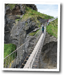
Key attractions: ‘Old Bushmills’ Distillery; Dunseverick Castle; White Park Bay; Rathlin Island; Carrick-a-Rede Rope Bridge; the Giant’s Causeway; Ballintoy Harbour; and Dunluce Castle.
Credit: Peter Miller
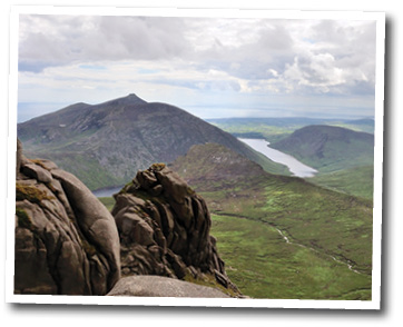
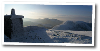
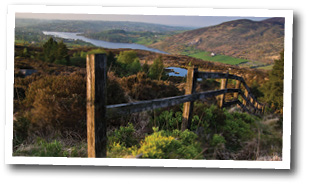
Mourne
County: Down
Designated: 1986
A haven to hillwalkers, mountaineers and cyclists as well as a muse of poets, the centrepiece of the AONB is the 50 million-year-old granite range of the Mourne Mountains which stretches for 24km between Newcastle to the north and Rostrevor to the south. However, The Mourne AONB also encompasses the farmed drumlin of the Slieve Croob region, Dundrum Bay, Carlingford Lough and 40km of coastline.
The name, historically spelled as ‘Morne’, derives from the Múghdhorna clann, while Slieve is an Anglicisation of ‘sliabh’ or ‘mountain’.
The highest peak of the Mournes, Slieve Donard (Sliabh Dónairt or ‘Dónairt’s mountain’), stands at 850m above Newcastle alongside its neighbour, Slieve Commedagh (Sliabh Coimhéideach or ‘the watching/guarding mountain’) at 767m.
Built in the first two decades of the 20th century, the Mourne Wall, a 35km dry stone wall, connects 15 mountain peaks and was first constructed to delineate land purchased by the Belfast and District Water Commissioners (and is currently maintained by Northern Ireland Water).
Key attractions: the Mourne Mountains; Slieve Croob; Tollymore Forest Park; Castlewellan Forest Park; Murlough Nature Reserve; Dundrum Bay; Newcastle Promenade; Silent Valley Mountain Park; Carlingford Lough; Cloghmore (‘the big stone’); Kilbroney Park; Dundrum Castle; Narrow Water Castle; and Greencastle.
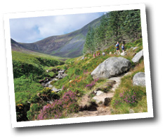
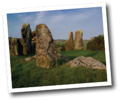
Ring of Gullion
County: Armagh
Designated: 1991
The AONB takes its name from the 573m peak of Slieve Gullion (Sliabh Cuilinn or ‘Culann’s mountain’) and the surrounding foothills – the remains of a ring-dyke volcano which erupted over 50 million years ago. Other peaks include Croslieve, Slievebrack, Camlough Mountain and Mullaghbane Mountain.
A walking route begins and ends in Slieve Gullion Forest Park, with the summit of Gullion revealing two burial cairns on either side of the Cailleach Bhéara’s Lough. The southern cairn is the highest surviving passage tomb in Ireland with a chamber that can be entered. From here, there are panoramic views of the Mourne Mountains, Carlingford Lough, the Cooley Peninsula, Armagh’s drumlins and as far south as Dublin Bay.
Humans have lived in the Ring of Gullion for over 6,000 years and, as such, the surrounding area has strong associations with Irish mythology. Fionn MacCumhaill is said to have been tricked to swim in the ‘cursed’ lough at Gullion’s summit, while according to the Ulster Cycle, it is also the place where Cú Chulainn received his name and where he spent his childhood as Sétanta.
Key attractions: Slieve Gullion Forest Park (including Hawthorn Hill Nature Reserve, the Adventure Playpark and the Giant’s Lair); Killeavy Castle; Killeavy Churches; Camlough Lake; Kilnasaggart Stone; Ballykeel portal tomb; the Dorsey; and Moyry Castle.